The French Republic consists of metropolitan France (mainland France, the coastal islands and Corsica), the overseas départements, the overseas territories (Nouvelle Calédonie, Wallis et Futuna, Polynésie, Austral islands and Terre Adélie) and the 'collectivitésterritoriales' of Mayotte and St-Pierre-et-Miquelon. Only metropolitan France and the overseas départements are considered part of the EU.
For the most part, the administrative division of France dates back to the beginning of the revolutionary period (1789-1790). There was little change in its organization until the Law of 5 July 1972, which created the regions. In particular, the départements, created in February 1790, have undergone few changes, apart from annexations and territorial losses (the loss and return of Alsace and Moselle, the annexation of the Papal States and the return of Nice and Savoy). The most recent changes have been the reorganization of the Paris region (Law of 10 July 1964) and the re-division of Corsica into two départements (Law of 5 May 1975).
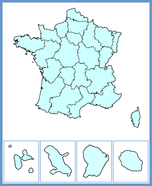
The area covered by Metropolitan France is 543 965 km2, which makes it the biggest country in the European Union. It is divided into 22 regions, 96 départements, 329 arrondissements, 3 879 cantons and 36 564 communes. This high number of communes means that France is divided into much smaller units than its neighbouring countries. France accounts for almost half the communes in Europe and 87% of them have fewer than 2 000 inhabitants.
The Pyrenees and the Alps are the two main mountain ranges in the country. The other mountains of the country, the Jura, the Massif Central, the Massif Armoricain, the Ardennes and the Vosges are of medium size. Four major waterways dominate the hydrography of the country: the Loire (1 010 km), the Seine (770 km), the Garonne (650 km) and the Rhone (522 km "in France"). The Rhine constitutes the border between France and Germany for a distance of over 190 km. The coast of Metropolitan France covers nearly 3 000 km.
The four overseas départements, which also have the status of regions, are Guadeloupe and Martinique in the Atlantic Ocean, Réunion in the Indian Ocean and French Guiana on the American continent. They have a population of 1.7 million. Guiana is the largest French region (83 534 km2 or 15% of the territory of Metropolitan France).
This text, finalised in March 2004, is based on the information published by INSEE France on the CD-Rom « La France et ses régions » in 2003.