The Republic of Lithuania forms part of the eastern coast of the Baltic Sea. To the north of Lithuania lies Latvia, to the east and south Belarus, and in the southwest it borders Poland and the Kaliningrad region of Russia.
The land area of Lithuania, which covers 65 300 km2, is larger than that of Belgium, Denmark and the Netherlands and in it lies the exact geographical centre of Europe, Purnuskis, which is 27 km north of Lithuania's capital, Vilnius.
The country was first consolidated into a unified state from a number of dukedoms by Grand Duke Mindaugas around 1235 AD. By the 15th century Lithuania was one of the most powerful states in Eastern Europe and around 1410 its army blocked the Mongols and, fighting shoulder to shoulder with Poland, totally defeated the Teutonic Knights in the battle of Tannenberg. Lithuanian-Polish co-operation developed into a federation in 1569 with the Lublin Union, forming a Commonwealth of the two nations, a Rzeczpospolita. This Commonwealth lasted until Lithuania was incorporated into Russia in 1795.
After more than a century of Tsarist rule, Lithuania in 1918 declared its independence, which lasted for only 22 years, as in 1940 the Soviet Union occupied the country. On March 11 1990, Lithuania proclaimed the restoration of independence, and in September 1991 the Republic of Lithuania joined the United Nations.
The Baltic tribes, which originally settled in the territory of Lithuania in the 7th to the 2nd century BC, are the Lithuanians of today. The Lithuanian language is the oldest Indo-European language still in everyday use. Ethnically and culturally distinct from the other Baltic States, Lithuanians form 83% of the population, with Poles forming the second largest ethnic group at 7%, while Russians amount to 6%.
Overall, the total population, some 3.5 million, is close in size to that of Ireland. Women outnumber men by 14 per cent in Lithuania. The reasons for this are World War II and the resistance to Soviet occupation.
Before World War II, Lithuania was an independent state closely integrated into the world's economy. However, the annexation of Lithuania to the Soviet Union in 1940 abolished the functioning of the market economy. The economy of the country started to move back towards a market economy only in 1990. At the outset of this process a decline in production took place and considerable changes in employment were observed.
Privatisation and liberalisation programmes have commenced, the conversion of production has been carried out and the introduction of a national currency, the Litas, has helped to overcome the crisis and to stabilise the economy.
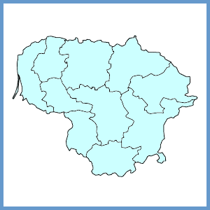
Since July 1994 the Seimas (Parliament) of the Republic of Lithuania has initiated reform of the territorial administrative units which has resulted in the emergence of 10 counties (Alytus, Kaunas, Klaipeda, Marijampole, Panevezys, Šiauliai, Taurage, Telšiai, Utena and Vilnius). This division corresponds with the NUTS level 3 of the regional criteria. Counties were further subdivided into 60 municipalities and 524 neighbourhoods. As the main flow of transit goods crosses Lithuania from the West to the East and from the North to the South the geopolitical location of the country should be significant for the future development of Lithuania.