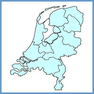
Following Belgian independence in 1830, the Netherlands comprised 10 provinces. This was increased to 11 in 1840 when the province of Holland was split into the provinces of North and South Holland. From 1986 onwards the Netherlands comprises 12 provinces: with reclaiming land from the former Zuider Zee the official birth of the twelfth province Flevoland was a fact.
Provinces in the Netherlands fulfil an intermediate role between central government and local government. They have responsibilities in fields such as town and country planning, the environment, infrastructure and regional policies. The ongoing debate on the need for a new administrative structure in between the trinity central government, provinces and the municipal level has led to several experiments of aggregating local administrations. However there will be no so called fourth administrative layer, but only a modest form of imperative local cooperation in seven areas in the beginning of 2005. The number of municipalities has dropped considerably in the last few decades. With 489 municipalities in 2003 the number of municipalities is only half the number in comparison with 1960.
For purposes of regional economic analysis, the Regional Research Programme Coordinating Committee (COROP) divided the Netherlands into 40 regions in 1972. The main criterion for the breakdown into COROP regions is that of nodality; other criteria include the natural features of the land and historical ties. This regional breakdown provides a very useful set of statistical units and is important for regional analysis purposes. The COROP regions are not, however, administrative units. They represent NUTS 3 in the Netherlands, and are made up of municipalities. As they do not straddle inter-provincial boundaries, they can be combined at provincial level (NUTS 2).